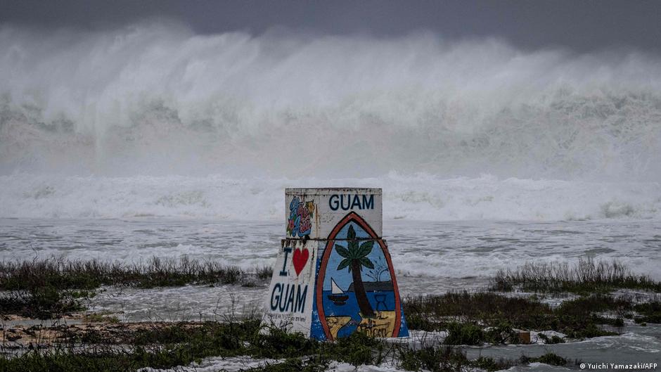
Super Typhoon Bavi struck the US Pacific island territories of Guam and the Northern Marianas, bringing torrential rains and hurricane-force winds.
Bavi made landfall on Rota, the southernmost island of the Marianas, on Monday, according to the National Weather Service.
“The western eye of Super Typhoon Bavi is currently passing over the island of Rota. The latest forecast peak intensity is 180 mph (290 kph) as it passes over Rota,” the NWS said. “Damaging winds in excess of 150 mph will continue in Rota throughout the eyewall’s passage.”
The Joint Typhoon Warning Center said Bavi was forecast to move westward over the archipelago in the western Pacific Ocean on Monday morning, bringing maximum sustained winds of 280 kilometers (173 miles) per hour and gusts of 333 km/h.
According to the National Weather Service (NWS), super typhoons are equivalent to a Category 4 or Category 5 hurricane.
The NWS warned that the “very dangerous” storm was expected to cause “catastrophic wind damage,” as well as storm surge and “dangerous” surf near the storm’s eye.
What do we know about Bavi’s predicted path?
The eye of the hurricane is expected to pass closest to Rota Island, which lies between Guam and the Northern Marianas, around 8 a.m. on Monday (2200 GMT Sunday).
The NWS also said Rota was prepared for “extremely dangerous hurricane-force winds.”
“Treat these impending extreme winds as if a tornado was approaching and immediately move to an interior room or shelter!” the agency said in a post on X.
According to the forecast, if Bavi moves over or near Rota, much of the area “will remain uninhabitable for weeks, perhaps longer.”
“Many non-concrete, non-reinforced homes will be destroyed, roofs will be completely damaged and walls will collapse,” the NWS said, adding, “Almost all trees will be snapped or uprooted and power poles will be downed… Power outages will last for weeks to possibly months.”
The NWS said flash flood warnings were also in effect for Saipan and Tinian in the Northern Marianas.
Most seek shelter but some are hit by the waves
The two US territories are home to a combined 210,000 people, but the islands’ streets were largely deserted on Sunday afternoon as people received official advice to shelter in place.
Shops, restaurants and other businesses were closed ahead of the storm’s arrival Sunday night or early Monday.
While most of the islands’ residents stayed indoors, about a dozen surfers made the most of the rough conditions at Guam’s Talofofo Bay.
The region is still battling Typhoon Sinlaku
Bavi is set to enter the archipelago on Monday morning, with the region still recovering from Super Typhoon Sinlaku in mid-April.
Sinlaku, the world’s most powerful tropical cyclone this year, cut power to thousands of people and caused massive damage.
Power has still not been fully restored in parts of the Northern Mariana Islands, with some people living in tents after high winds destroyed their homes.
Another major storm, Mawar, also occurred in 2023. That storm was the region’s largest storm in decades.
Hurricanes become worse due to El Nino
Record temperatures have been recorded in the world’s oceans in June 2026. The European Union warned on Wednesday that more ocean temperature records could be broken in the coming months.
When ocean temperatures are high, tropical storms become stronger and become seasons.
The United Nations’ World Meteorological Service said last week that El Nino, which typically occurs every two to seven years, has already begun in the Pacific.
The weather phenomenon increases sea surface temperatures in the central and eastern Pacific Ocean, affecting global wind and weather patterns.
Edited by: Dmytro Lyubenko
Don’t let algorithms hide news. If you trust our team for reliable reporting, please take a moment to select us as your preferred source on Google click here And press the “Star” or “Favorite” button so you always see our verified news first.