In July, hundreds of firefighters battled flames in Spain, Portugal and France.
A map from NASA’s Fire Information for Resource Management System (FIRMS) shows more wildfires: Red dots are scattered all over the world – essentially only the white areas of Greenland and Antarctica are excluded. Each dot marks a hotspot or active fire detected by the satellite.
Due to heat waves and drought, wildfires are occurring more frequently around the world.
They often start quite unnaturally – a discarded cigarette or a spark blown from a campfire is enough to set fire to dry leaves and small branches. After that, quick action is important to extinguish the fire before it engulfs larger areas.
Early detection of fire through satellites
However, in order to take prompt action, early detection of small fires is required. This problem is more prevalent in remote areas. But before the human eye can see the rising flames or smoke, satellites may have already sounded the alarm.
There is much satellite data available, such as from FIRMS. Global data is publicly available within three hours of satellite observation – in the US and Canada, some of it is even available in real time.
The European Forest Fire Information System (EFFIS) also provides free data for Europe, the Middle East and North Africa based on information from NASA, Copernicus and the European Earth Observation Programme.
Despite all this free data, Munich-based startup OroraTech has developed a business model for detecting wildfires. The formula: satellite data, artificial intelligence (AI), service – and all of it fast.
Monitoring wildfires in real time from space
“The systems from NASA and the European Space Agency (ESA) usually only take images at a specific time of the day,” explains Thomas Grubler, Chief Strategy Office at Ororatec. For example, only in the morning or afternoon.
However, wildfires usually begin to erupt in the middle of the day. AuroraTech fills this “afternoon gap” with its satellites.
Furthermore, the data provided by conventional satellites is not suitable for fire detection. Small fires may be missed if the camera’s resolution is not high enough.
As a result, critical data may be delayed in reaching firefighters. During that time, the fire can spread without detection.
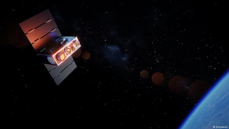
In spring 2022, Ororatec launches its first satellites into orbit. The satellites are equipped with thermal infrared sensors that detect temperature differences, enabling them to detect heat at night and through smoke, although dense clouds can still limit observations.
What makes them special, says Grubler, who co-founded the company in 2018, is that the cameras have been miniaturized to fit inside a satellite the size of a shoebox. This makes them cheap and require only a fraction of the energy of larger satellites.
How AI turns wildfire data into action
According to the company, they currently operate more thermal imaging satellites than any other country or company in the world. By 2028, the number of daily scans is set to reach a level where every point on Earth will be scanned every 15 minutes.
However, locating the sources of fire is not enough.
“We make this data actionable,” Grubler says.
To achieve this, AuroraTech uses AI to analyze not only its own data, but also that of other satellites operated by ESA and NASA.
Customers thus receive information about the sources of a fire within minutes, as well as continuous updates on the potential progress of the fire and an assessment of its consequences.
Who uses OroraTech wildfire data?
Its customers in 25 countries include government agencies, fire departments, forestry companies, infrastructure and energy providers, insurance companies and environmental organizations.
AuroraTech now also sells data from its satellites to ESA and NASA.
The company has also won over the Greek government.
In collaboration with ESA, a system was developed specifically for Greece, consisting of four satellites, a ground station in Greece and Ororatec’s Wildfire Solution Platform. This enables continuous delivery of wildfire detection data in real time across Greece.
Systems that help emergency response teams better organize themselves are particularly useful in countries where fires occur and spread very quickly.
According to its data, Ororatec monitors 407 million hectares of forest worldwide – an area almost as large as the European Union – which includes areas in Brazil, Chile, the US, Canada and Australia.
New uses for thermal satellites
“I didn’t expect the entire market to move from niche to mainstream like this,” Grubler says. “By now, we are deeply involved and experts in the field of wildfire,” and due to the increasing number of fires, the market is likely to grow.
Apart from wildfire detection, other potential business areas are also emerging.
After all, not only fire can be measured, but also all types of heat emissions. For example, information on how much water evaporates from fields can be collected for agriculture, heat islands can be identified in populated areas, oil spills in the ocean can be detected, and thermal data can even prove useful in the defense sector.
Among other applications, ships can be detected from space even when they have turned off their transponders.
“I suspect that in five years there will be use cases that we don’t even know about today,” Grubler says.
This piece was originally published in German.