India is turning Great Nicobar Island, its southernmost territory in the Bay of Bengal, into a key strategic asset.
Located at the tip of the Andaman and Nicobar chain, closer to Indonesia’s Sumatra than the Indian mainland, the island lies near the Strait of Malacca, one of the world’s busiest shipping corridors.
New Delhi is investing about $9 billion (€8.3 billion) to build a transshipment port, airport, townships and supporting infrastructure.
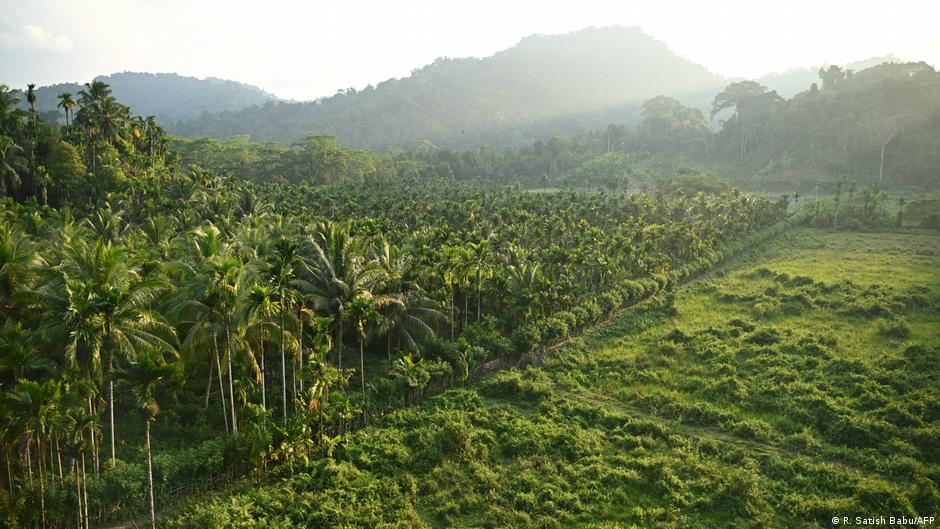
However, the project has also faced criticism over its environmental and social impact, including the felling of approximately 852,000 trees, and risks to indigenous communities such as the Shompen.
New Delhi relies on geography to gain power
This scale reflects a shift in New Delhi’s strategic thinking, from a greater focus on mainland India to a more outward-looking maritime posture.
The geographical advantages are obvious: proximity to the Strait of Malacca provides the ability to monitor one of the main arteries of global trade, including a significant part of China’s energy flows.
But there is controversy over what consequences this proximity brings in military terms.
Former Air Marshal R Nambiar argues that the real value of Great Nicobar Island is that it allows India to deny control over the region to potential rivals.
“We don’t need to show strength. We need to stop the enemy from passing through our backyard,” Nambiar told DW.
He pointed to the challenges of confronting a “blue-water navy” – a navy capable of operating globally, far from its native shores – with an adversary that matches or surpasses India’s own capabilities.
Nambiar said, “India must be prepared to face a ‘peer-plus’ navy, where large surface fleets are increasingly exposed to precision strikes and aerospace power. A blue water navy that cannot survive in the first place… controls nothing.”
“The land base is not submersible. We must focus on choke points and use geography to our advantage,” he said.
China’s increasing presence in the Indian Ocean
In India’s strategic thinking, these calculations usually focus on China – its neighbor and the only country in the world that rivals it in terms of population.
Beijing has spent two decades building influence in the Indian Ocean, gaining port access in Sri Lanka, Pakistan and Djibouti, deploying submarines and surveillance ships with regularity and mapping sea floors in areas that Indian planners consider its strategic backyard.
Great Nicobar is, in part, India’s answer to that accumulation of pressure.
Last week, former Air Chief Marshal RKS Bhadauria pointed out that the creation of new infrastructure would be a significant development in India’s ability to secure its trade routes and dominate the maritime environment whenever required.
“Strategically, it is important to understand that this will provide us with the capability to be located just 150 kilometers away from the Strait of Malacca. This will provide a significant boost to our overall domain awareness in both the air and maritime domains,” Bhadauria said in an interview with the Press Trust of India (PTI).
Tracking China’s footprint around Great Nicobar
But countering China’s military power is only part of India’s equation for the development of Great Nicobar.
Srikanth Kondapalli, a professor of Chinese studies at Jawaharlal Nehru University, told DW that the driver of the project is “economic first, strategic second.”
“If you look at China, it has developed about 3,000 islands since the 1990s and a significant portion of its economic activity now flows through them,” he said.
“India is also trying to do something similar,” he said, pointing to plans to build a transshipment terminal, an airport, townships and energy infrastructure in the island’s Galathea Bay “to boost trade and reduce dependency.”
He warned that China’s presence in the Indian Ocean cannot be ignored.
“China is sending submarines and more than nine surveillance ships every year. We have seen Chinese ships dock in Male and earlier in Hambantota after passing through the Andaman and Nicobar chain, despite Indian concerns,” the expert said.
“China monitors Indian space launches from Great Cocoa Island, is mapping the Bay of Bengal, and expanding fishing activity in the Indian Ocean while restricting access in the South China Sea.”
For Kondapalli, this duality defines the project.
“The infrastructure being built is intended to be economic, but depending on the threat level, it could be used for military purposes. Its long-term strategic impact remains uncertain,” he said.
India’s long bet on power and presence
The Great Nicobar buildup strengthens India’s operational position, but it has clear limits, said Atul Kumar, fellow in national security and China studies at the Observer Research Foundation.
“Its development enhances surveillance, intelligence and reconnaissance, enabling faster response and more reliable deterrent signaling,” he told DW.
“Advance infrastructure on Great Nicobar Island will increase air access, reduce patrol distances and improve the long-term deployment capability of aircraft and naval assets.”
But he cautioned against exaggerating his influence.
“This does not prevent a halt. Sustained intervention will require far greater capabilities and coordination,” he said.
He said India needs a bigger fleet, more submarines and stronger partnerships to turn geography into de facto control.
The distinction between prevention and control underlies the most serious evaluations of a project.
Ashok Kantha, India’s former ambassador to China, said the island’s geographical location was indeed valuable, but cautioned that it was too early to draw “definitive conclusions” on India’s operational power.
“Great Nicobar is being developed to reduce dependence on foreign transshipment hubs, accelerate humanitarian and disaster response, and strengthen India’s maritime presence in the eastern Indian Ocean,” Kantha told DW.
“Its proximity to the Malacca approaches makes it valuable for monitoring sea lane activity, but converting that geographic advantage into sustained operational power will depend on logistics, force positioning, and broader political and economic choices,” he said.
Edited by: Darko Janjevic